PHILADELPHIA (WPVI) — As the East Coast digs out from a massive snowstorm, a potential nor’easter could bring more snow to parts of the Philadelphia region this weekend.
A “bomb cyclone,” or a rapidly intensifying storm, is forming off the Carolinas Friday night into Saturday.
“This is going to be a monster storm. It is going to rapidly intensify as we get this fresh injection of arctic air that comes in here Thursday, Friday, and that helps develop the storm with upper-level energy,” said Meteorologist Adam Joseph.
The system is expected to bring snow to North Carolina, South Carolina and parts of Virginia.
What about the Philadelphia region?
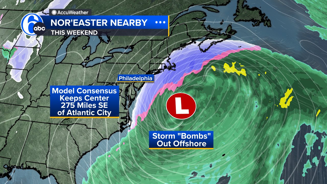
As of now, the latest model guidance for our region still depicts a glancing blow late Saturday into Sunday.
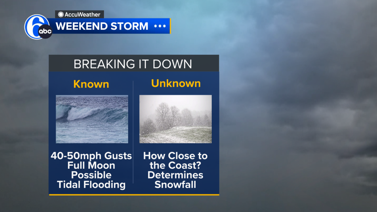
Model consensus keeps the center of the storm almost 275 miles southeast of Atlantic City, with the biggest impacts likely to be felt at the shore. Some of those impacts include 40-50 mph wind gusts and tidal flooding, especially with a full moon on Sunday, leading to already high astronomical tides.

What remains unknown is how close the precipitation shield will get to the East Coast. With such a moisture-laden storm, a shift of just 30 to 45 miles could significantly change snowfall totals.
How much snow?
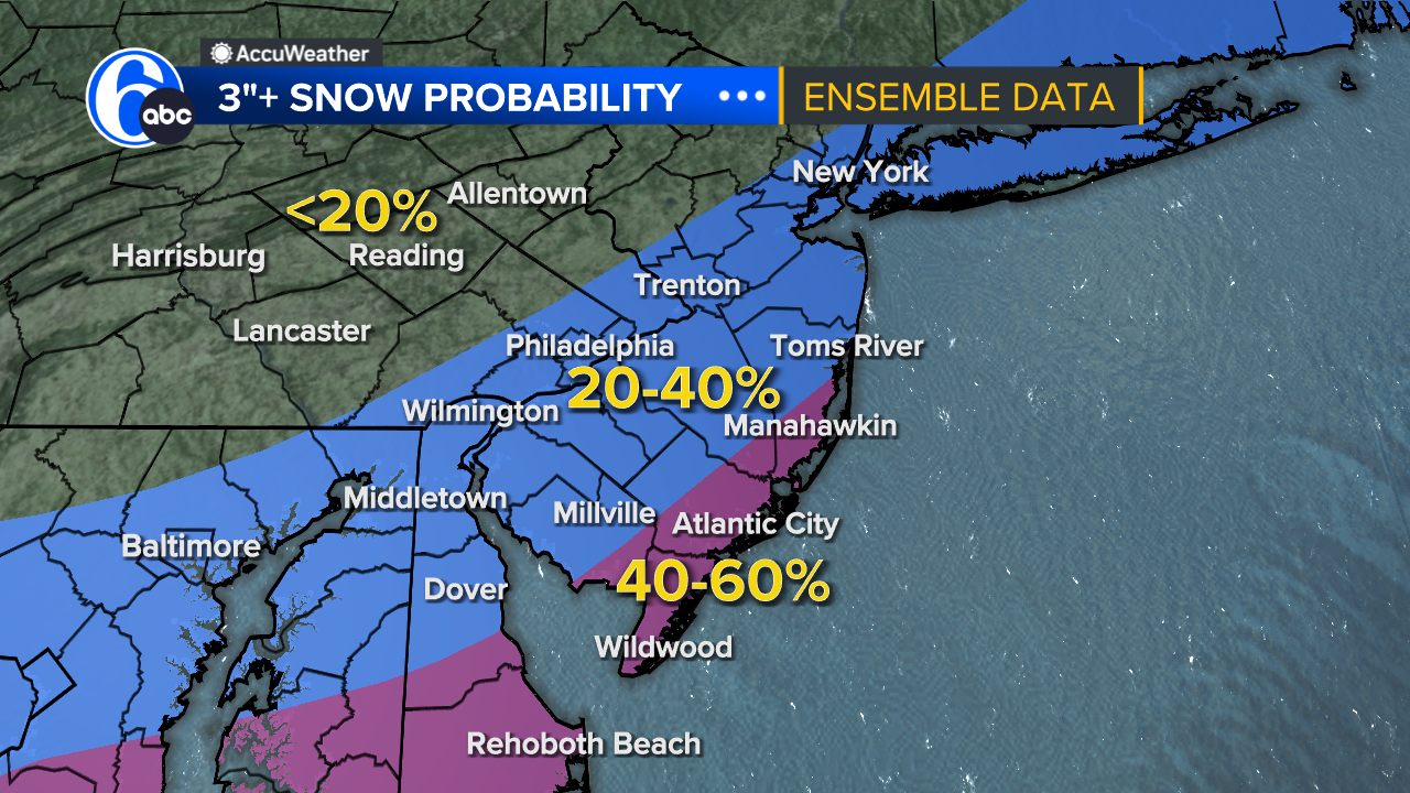
As it stands now, a blend of the GFS and Euro models shows about a 40-60% chance of 3 inches or more of snow for the Delaware beaches and the Jersey Shore. That number drops to near 20% for the I-95 corridor, suggesting a 3-inch snowfall is not likely for Philadelphia at this point.
Nor’easters along the East Coast get their name because the winds over coastal areas typically come from the northeast. These storms may occur any time of year, but are most frequent and most powerful between September and April.
Stay with Action News as we continue to track the storm. You can always get your latest forecast at 6abc.com/weather.
Copyright © 2026 WPVI-TV. All Rights Reserved.